Photo: Praveen Chettri
In the last two decades, the eastern Himalaya has witnessed major transformations in its environmental and urban landscape. Accelerated urbanisation, especially for tourism accommodation, and the construction of new ‘scenic spots’ for touristic consumption have gradually changed the landscape of the region. These have been complemented by major infrastructural development (expansion of the national highway, railway line) to facilitate the easy movement of goods and people (locals, tourists and the defence forces), continued construction of hydropower dams, and pharmaceutical factories, especially in Sikkim.
Sprawling urbanisation, construction of hydro-power dams and pharmaceutical factories, new major infrastructural projects, are all taking place within a ‘bio-diversity hotspot’, an environmental zone of immense significance; and one that is equally fragile. Despite the urgency of the situation, there exists either a remarkable silence on environmental issues (especially over ‘controversial topics’) and the adaptation, mitigation strategies that need to be adopted by the government as well as the public.
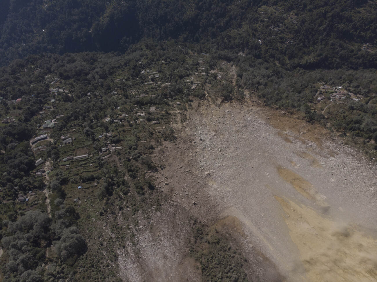
Photo: Praveen Chettri
Nonetheless, while most of us are either turning a blind eye or learning to live with environmental (natural and man-made) hazards, Save The Hills (STH), a Kalimpong (West Bengal) based non-governmental organisation has been working on disaster risk reduction in the eastern Himalaya. Specifically, STH focuses on landslide hazards and their pervasive impacts on the lives and livelihoods of the people of Darjeeling and Sikkim Himalaya. STH is committed to trying to find ways and means of raising awareness, firstly among the affected people and then among national and international audiences about the serious landslide hazard problem of the region. STH also provides a rudimentary early warning through satellite imagery about the onset of heavy rain and updates inputs on the landslide situation in the region regularly.

Photo: Praveen Chettri
The genesis of STH can be traced back to the extreme rainfall event that took place in the first week of September, 2007 and its devastating aftermath in the Darjeeling-SikkimHimalaya. The havoc unleashed by the torrential rains prompted Wg Cdr Praful Rao (retd) of Kalimpong to traverse the length and breadth of the Darjeeling hills - taking photographs and documenting the widespread disaster and devastation on the internet, causing huge losses of infrastructure and also fatalities in the fragile hill areas. These photographs and reports led to the creation of the STH blog: www.savethehills.blogspot.com, which serves as an important, and perhaps the only, online archive for landslides, extreme rainfall events and disasters in the Darjeeling - Sikkim Himalaya. Today, it has a world-wide audience and has more than 400,000 hits.
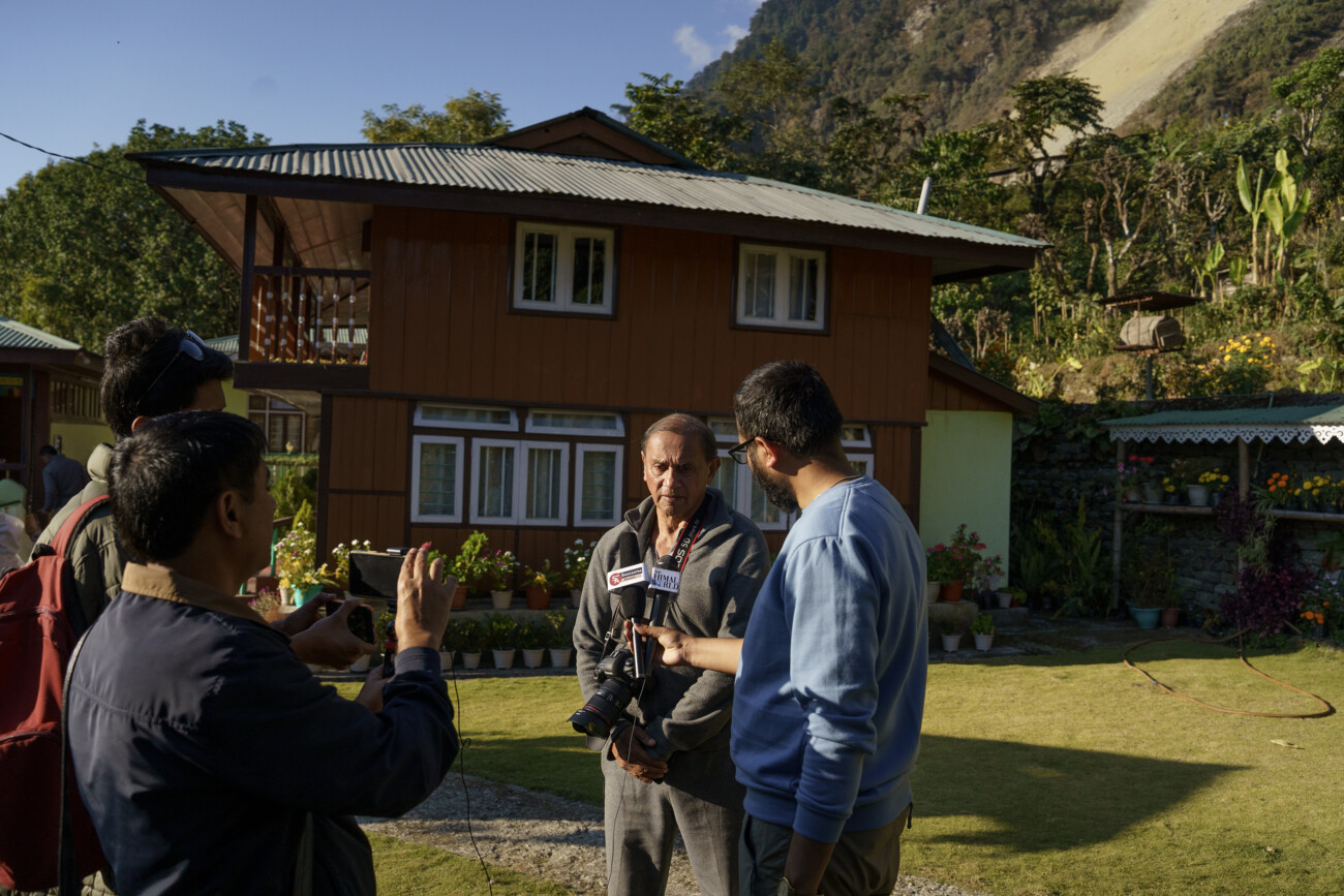
Photo: Praveen Chettri
STH also specifically provides insights on landslide hazard in Darjeeling Himalaya by monitoring and maintaining a landslide database, monitoring and tracking changes in rainfall pattern and intensity, which provides invaluable information to the local administration and research scholars. A social media offshoot of STH, which today functions as a crowd sourced information and knowledge hub in the region is Hazard Alerts ( HA), a WhatsApp Group which has a diverse membership including 25 odd PhDs, academics, media personnel, bureaucrats, NGOs and most importantly members from remote villages. HA not only serves as a citizens early warning centre for extreme rainfall events in the Darjeeling-Sikkim Himalaya but also endeavours to provide updated information on rainfall data, road conditions during the monsoons, traffic snarls and a host of environmental data which affect the lives of the people.
STH is a voluntary organization that relies more on the credibility it has at all levels rather than the numbers of its members. It has little funding but a whole lot of goodwill, which has allowed it to not only survive but also thrive in the mountains of Darjeeling and Sikkim.
Project Sikkim spoke to Praful Rao to get a better understanding of landslide hazards in the Eastern Himalayas
1.What are the main causes for landslides in the eastern Himalaya? Is it the geography, human intervention or both?
Landslides will take place naturally under the right conditions, in any mountainous region. Human beings by the numerous interventions in the mountains, many of which are thoughtless, and unplanned, exacerbate this process. And of course, the Himalayas remain the youngest and most fragile ranges on earth which we should treat with utmost care and respect.
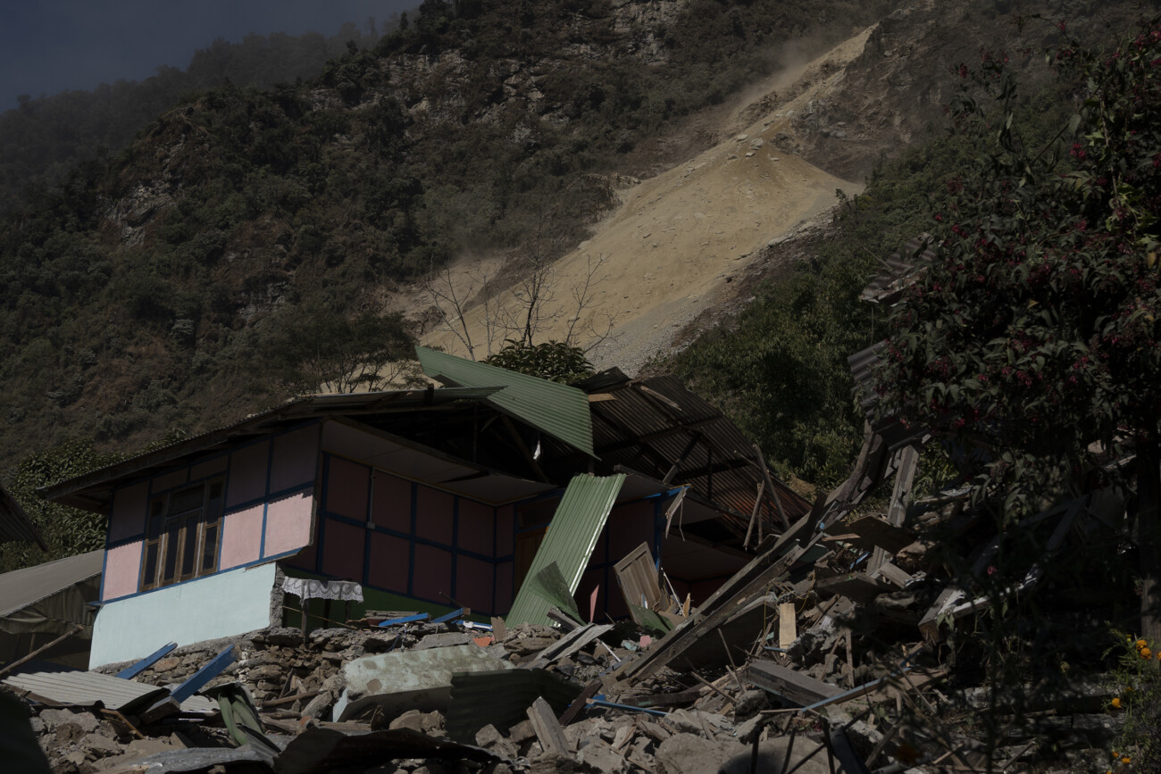
Photo: Dishant Chettri
2. Have the frequency of landslides increased? Are new spots emerging? If yes, why? Where are the landslide hotspots in the eastern Himalayas?
I cannot say definitely unless one consults a landslide data base for the entire North East region. Geological Survey of India (GSI) would be able to answer this better. What is very evident is that there is a strong human footprint in most landslides and that rain patterns are also changing.
The poor and inadequate drainage systems especially in our growing mountain cities and towns will emerge as a major trigger for landslides.
3. Is climate change exacerbating the situation? How?
Most probably, but it is too easy to blame everything on climate change. We don't have sufficient data to support this. The lack of data on anything in the Eastern Himalayas is really appalling.
4. Is there adequate technology and data on landslides in the region that could help local communities as well as the government mitigate/adapt?
Landslides are a disaster form which can to a large extent be controlled and mitigated if action is taken on time and today lots of different methods, ranging from very effective traditional methods to extremely expensive state of art technology exists to harness a landslide. Disaster Management is a state subject and it depends on the priority the state or district administration gives towards this end. To start with we should have a network of AWS which can map our rainfall and rainfall patterns correctly – STH has made some headway in this
5. How can we ensure there is more, and better education about our mountain ecology, and landslides?
I think landslide and disaster studies must be made a part of the curriculum. Children must be made aware of the fragility of our mountains and that we cannot rape mother nature without paying a price.
Documenting Pathing Landslide
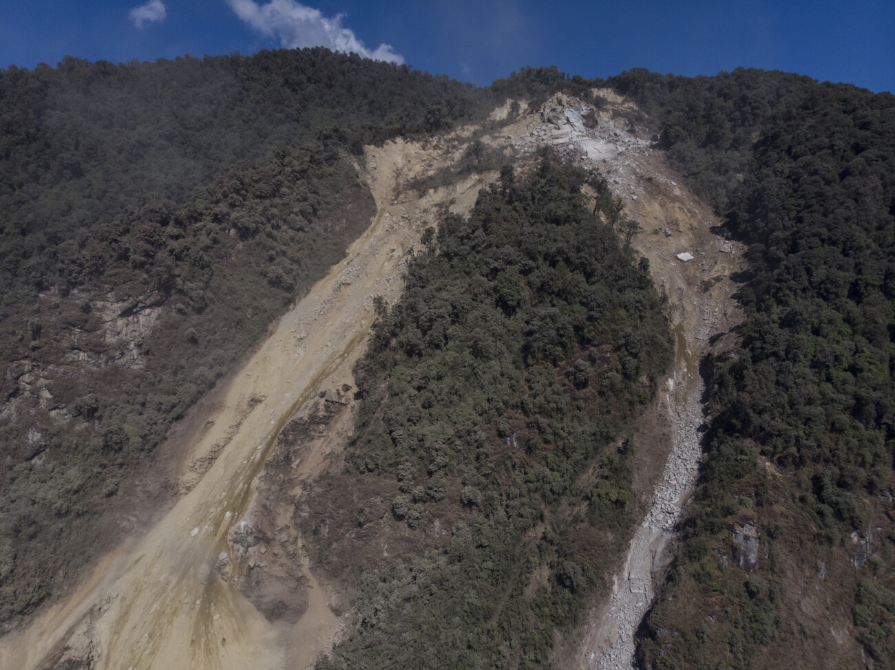
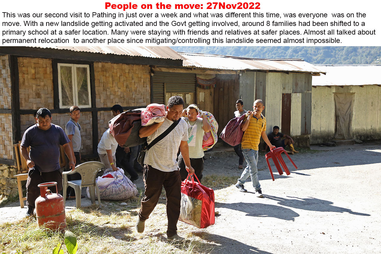
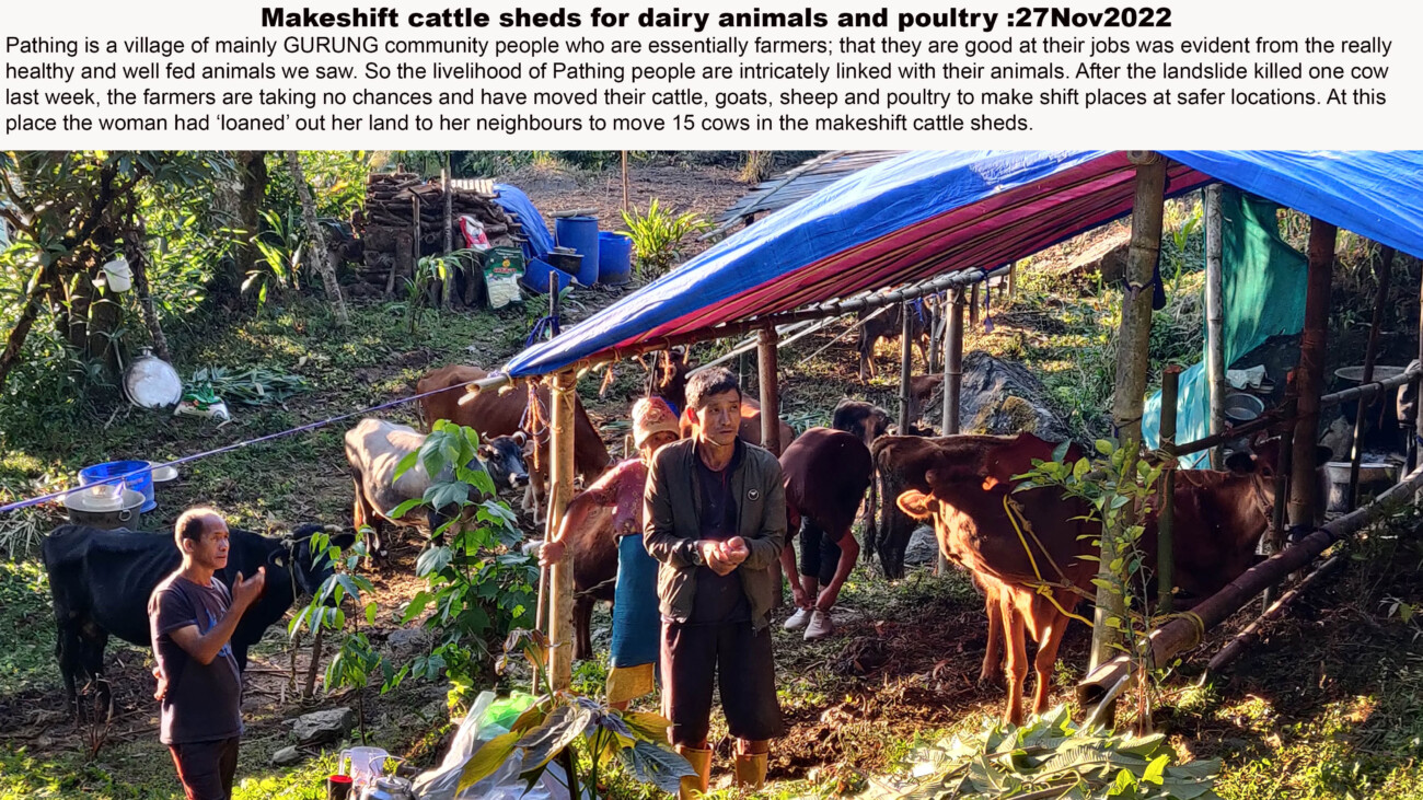
Pathing is a small village in south Sikkim, nestled between the towns of Yangyang and Ravangla. For more than thirty-years, Pathing, village of predominantly Gurung agriculturists, has been a site of a major and active landslide. Praful Rao from STH and a drone crew from Junkeri Studios (Kalimpong) visited the site on 18 November, 2022. They interacted and interviewed many of the affected people from Pathing, took photographs and drone footage of the landslide and its impacts. The photo essay is based on this and subsequent other visits by the team. STH along with Junkeri Studios have produced two documentaries on the impact of the landslide at Pathing in order to raise awareness and garner support for local communities affected by the landslide.
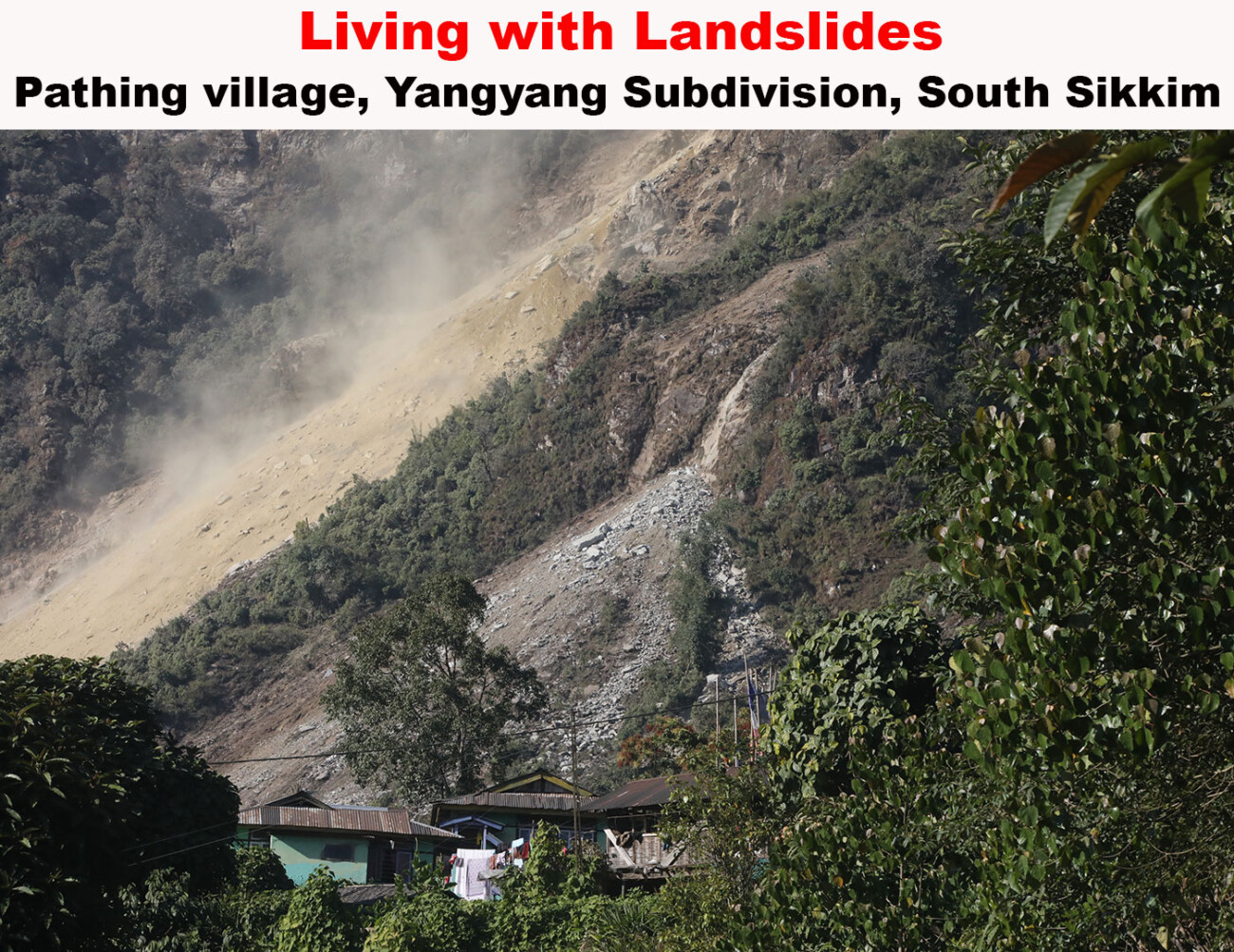


Discussions with local communities revealed that, while no one knew what triggered the original landslide some thirty years ago, in 2022 the landslide was more active than usual. This was evinced by the continuous rockfall even AFTER the end of the monsoon season; in fact, according to locals, the landslide was more active after the monsoons, rather than during it. Landslides, unlike flash-floods or earthquakes, usually build-up slowly and nibble away at hill-sides, one landslide at a time. And since their impact is seemingly easier to reconcile with, landslides are not often prioritised by government and disaster management professionals alike. Landslide are also very localised, for instance, one hill may be completely stable, and local communities, unaware of the devastation caused by landslide on an adjacent hill or mountain. This lack of awareness, is also exacerbated by the fact that remote mountain communities seldom speak out, and suffer in silence.

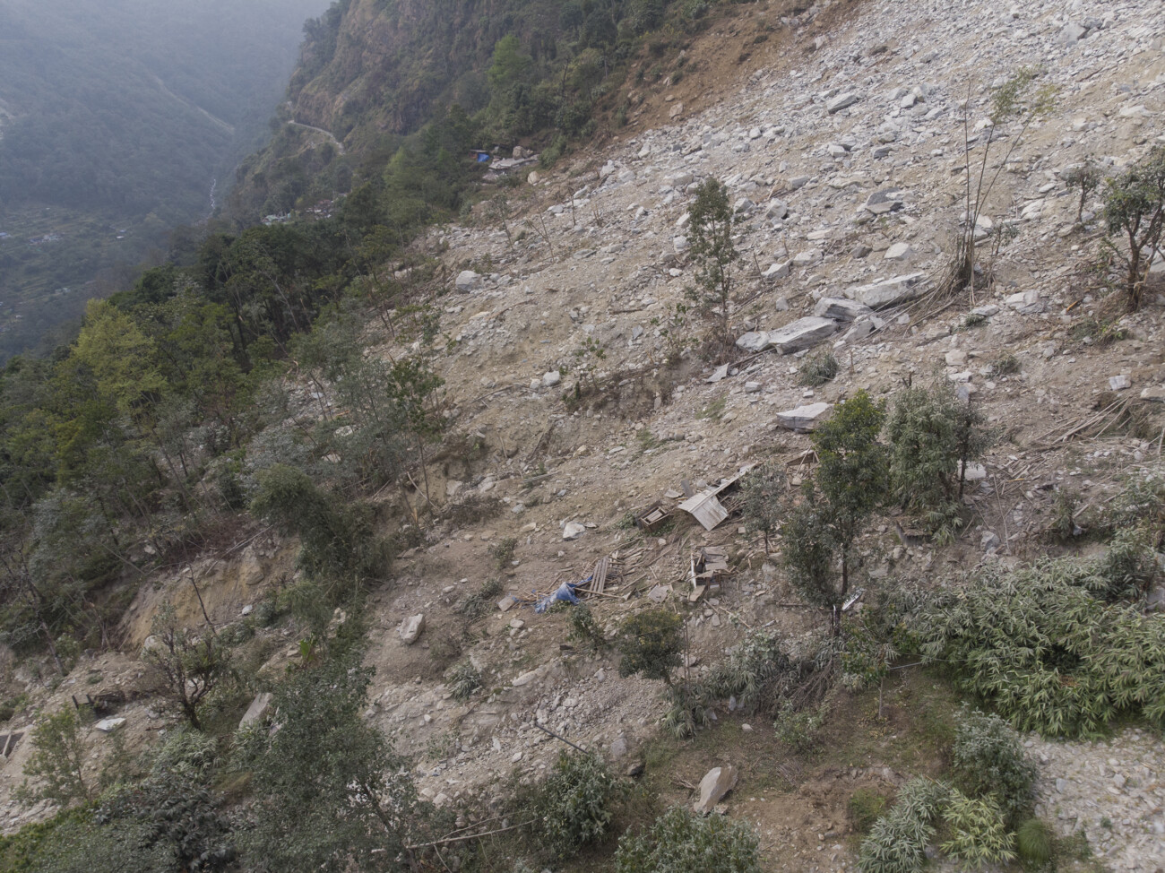
Photo : Praveen Chettri
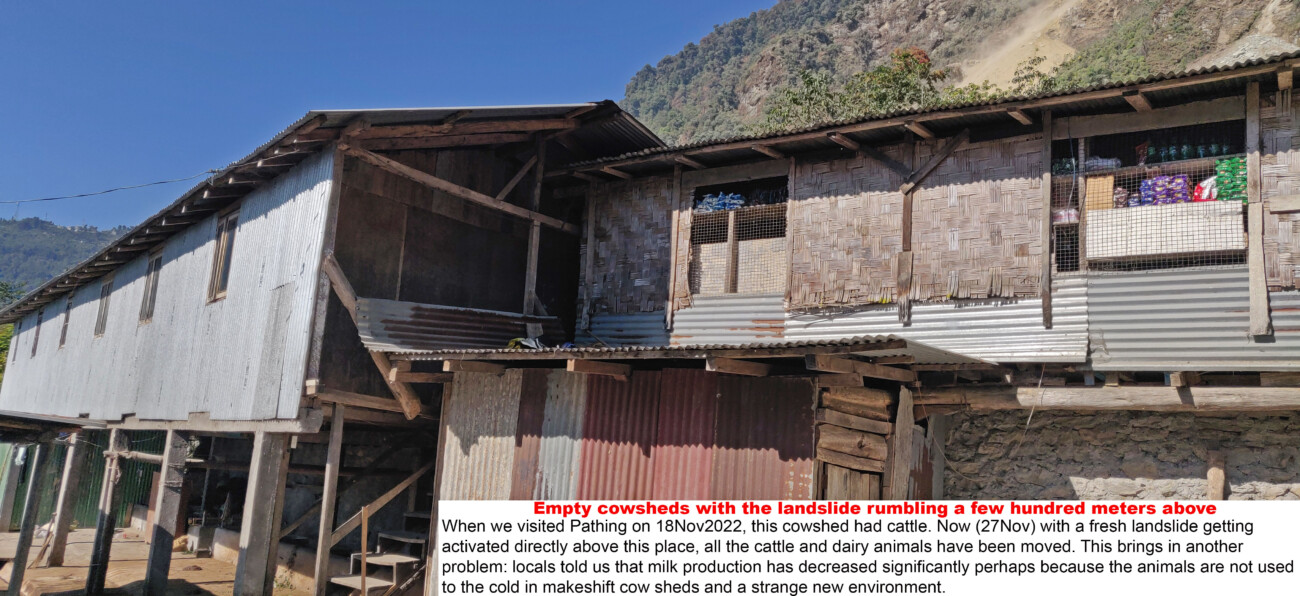
The impact of the landslide affected all aspects of the lives of Pathing residents. While the landslide activity affected road connectivity between Ravangla and Yangyang, the farming community lost large tracts of land as a result of shooting boulders; given the increased risk and unpredictability of the landslide, schools were adversely affected and the budding tourism industry suffered a complete setback.
According to experts, the Pathing landslide could be a result of
• the weak rock formations such as phyllites and schists in the mountain
• the steep (almost 60 -70 deg) incline of the slope failure.
.Photo: Praveen Chettri
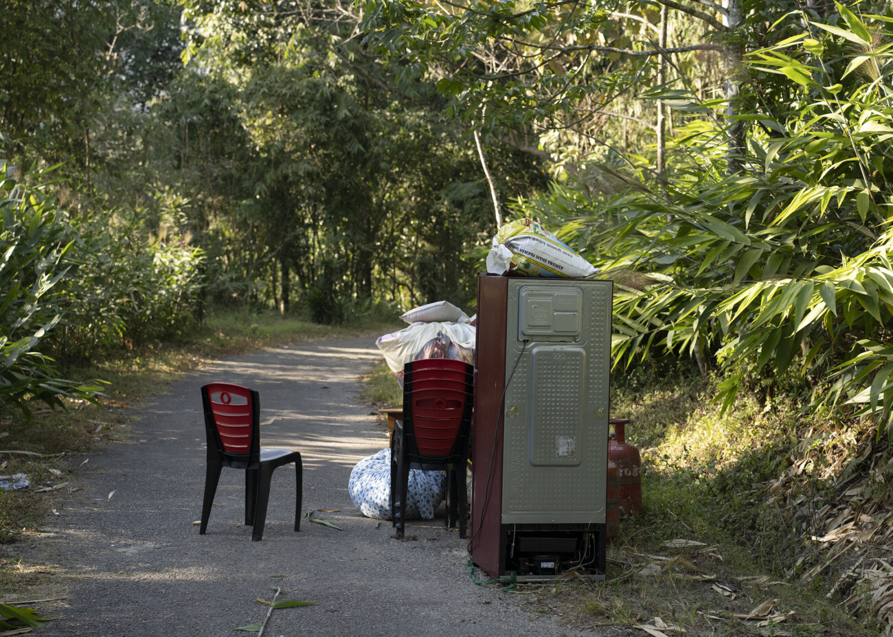
Landslide and disaster management experts and the villagers came to the same conclusion-- that it would be impossible to control or mitigate this landslide; thus, the only choice left for Pathing residents was to relocate to a safer place. This re-location would entail uprooting complete villages, and along with it their lives and livelihoods, leaving behind a trail of insecurity, and helplessness for all those who have lost their land and their community.
The Himalaya is geologically and seismologically sensitive. Landslides, flash-floods and earthquakes are common and have been occurring with increasing frequency. The environmental (natural and built environment) contexts within which they occur, too have been changing rapidly. The fear of environmental hazards is usually evoked only as a result of certain calamities, whether that be landslides, earthquakes, or flash-floods; and met with belated regret, despair and often soon forgotten. Perhaps it is time to take the environment, environmental hazards and our role within this eco-system more seriously, before it is too late.

Mona Chettri is a part of the Sikkim Project team. She is a well-known scholar of the eastern Himalayan region.
One comment on “PATHING, SOUTH SIKKIM: OUR OWN JOSHIMATH IN THE MAKING”
Leave a Reply
Latest Posts
Latest Comments
No 'Comments_Widget_Plus_Widget' widget registered in this installation.


Joshimath has been a crisis in the making for decades, as are the crises in every hill town in the Indian and Nepal Himalayas. In fact, the massive deforestation of Nepal is the cause of immense floods in Bihar and UP.Not only this,every urban area of India is facing a crisis caused by meddling with the environment: construction activity on natural drainage channels and lakes, destruction of nearby hills and forests, and industrial and municipal effluents and waste. India is an unmitigated environmental disaster with no light at the end of the tunnel.