The river Teesta that courses through Sikkim and Darjeeling-Kalimpong Himalaya is inundated with hydropower projects. A network of ‘cascade’ hydropower development, where dams, tunnels, and power stations are located at different stages of the river. These run-of-the-river projects encompass not only rivers, but also valleys, hills, and floodplains of the entire region. Thus, the impact of hydropower projects also has a cascade effect. Hydropower projects therefore have to be seen in their entirety- as networks of dams, tunnels, power stations, and electricity overhead lines— that create irreversible interventions on the landscape and lives of the peoples of the region.
The advent of hydropower projects in Sikkim and Darjeeling-Kalimpong Himalaya has to be understood against the background of the economic transformations in neo-liberal India. The first micro-hydel project in Sikkim on Rani Khola- with an installed capacity of a mere 50KW was commissioned in 1927, this was followed by another small 2 MW hydropower station at Jali Power House, on Sang Khola. Even by 1978, Sikkim generated only 3MW from three hydel projects (Wangchuk 2015). At present, the total hydro potential of the state is 5352.7 MW (ENVIS) and has around 19 projects in various stages of exploration and completion. Fast forward to 2017, when Sikkim’s largest dam till date - the 1200 MW Teesta Stage III power project in Chungthang, North Sikkim was commissioned- which was subsequently decimated by the October 3 Glacial Lake Outburst Flood (GLOF).

Hydropower projects also need to be seen for what they enable — corporate greed, land-grabbing, corruption, privatisation of the commons, collusion of the private and public sectors and ecological destruction.
Hydropower projects also need to be seen for what they enable — corporate greed, land-grabbing, corruption, privatisation of the commons, collusion of the private and public sectors and ecological destruction. Sikkim’s transition into one of the key sites for hydropower development in north-east India can be attributed to increasing demands for a reliable energy supply to maintain economic growth and competitiveness, especially in the post-liberalisation era. And Himalayan rivers, with their immense potential for hydropower generation, were ripe for the taking.
One of the most important factors was the entry of private companies into the hydropower sector, which was enabled by the Government of India’s ‘Mega Power Policy, 1995’. Despite making an appearance in north-east India a decade later, hydropower exploration in the region went ahead at lightning speed. Within a year of its arrival in Sikkim, 24 letters of intent were issued to the private and public sector undertakings for hydroelectric generation by the Government of Sikkim, boasting a combined installed capacity of 4694 MW (Dorjee 2015).
Hydropower generation and distribution were also abetted by national policies like the ‘Policy on Hydropower Development, 1998’, and the ‘New Hydro Policy 2008’, which emphasise the ‘green’ credentials of hydropower as justification for its increased exploitation. Perhaps one of the most important policies is the ‘2003 National Electricity Act’, which introduced renewed privatisation and deregulation with an aim to attract new investors to the renewable energy market, minimise state intervention, and improve the provision of public goods. This opened the hydropower market to new, private investors with very limited accountability and experience in the construction of hydropower dams on Himalayan rivers.
However, hydropower projects are being commissioned and built in a region that is prone to seismicity, landslides, and most importantly- climate change experienced in the form of rising temperatures, glacial retreats, and changing rainfall patterns.
However, hydropower projects are being commissioned and built in a region that is prone to seismicity, landslides, and most importantly- climate change experienced in the form of rising temperatures, glacial retreats, and changing rainfall patterns. For communities living along the Teesta basin in the Sikkim–Darjeeling Himalaya, climate-induced changes and hydropower development are two important factors in the production and persistence of socio-economic and political vulnerability. Those experiencing the impacts of expanding hydropower in the region are rarely heard and their concerns are poorly understood.
Hydropower projects have not been without their fair share of controversies and confrontations. In 2007, the Affected Citizens of Teesta (ACT) led a very powerful and successful movement against the construction of hydropower dams in North Sikkim. The ACT was successful in framing hydropower development as a threat to the culture, history, and sacred landscape of the indigenous Lepcha community of Sikkim. Prior to this, the 30 MW Rathong Chu project had been cancelled in 1997 after large-scale protests by Buddhist religious leaders and monks in Sikkim. In the aftermath of the 2007 agitation by ACT, a large number of Hydro Energy Projects (HEPs) were either stalled or cancelled by the Government of Sikkim. However, in recent years, there has been a slow and very steady resurgence of HEP construction, most of which has been contracted to private companies without much publicity, resulting in devastating consequences.
The following photo-essay aims to capture some aspects of the devastation caused by the October 3, 2023 floods, in the downstream areas of Rangpo, Singtam, and Teesta Bazar. North Sikkim has also been severely affected, but we were unable to travel to the affected areas due to poor road connectivity.
Prior to its destruction by the October 4 GLOF, Teesta III HEP dominated the physical landscape of Chungthang. The reservoir walls rose high above the riverbed, the run-of-the-river dam, cutting off the downstream water flow, while concrete walls lined the confluence of the Lachen Chu and Lachung Chu, and the reservoir of green water waited to be diverted into the tunnels that burrowed through the hills. Teesta III was not without its own share of controversies around land ownership, environmental degradation, and influx of temporary migrants working on the dam-site. The project was stalled temporarily only to be revived in 2015, this time with the Government of Sikkim increasing its financial investment to fifty-one percent. The dam was known as the Sikkim-Urja project and was commissioned in 2017.


The Teesta basin in Sikkim Himalaya hosts numerous glacial lakes in high-altitude glacierized regions, including one of the largest and fastest growing South Lhonak Lake. While these lakes are mainly located in remote and unsettled mountain valleys, far-reaching Glacial Lake Outburst Floods (GLOFs) may claim lives and damage assets up to ten kilometres downstream.
On October 3, 2023, the South Lhonak Glacial Lake breached causing a GLOF. The Indo-Tibetan Border Police, who are stationed along the river, alerted officials, which initiated evacuation efforts downstream. The flood water made its way downstream with great velocity, reaching the Teesta III dam, approximately 60kms downstream, in just over an hour. The reservoir of the Chungthang dam already held approximately 5 million cubic meters (mcm) of water (Gupta 2023; Sirur 2023). The flood waters hit the 60m high dam wall, and within ten minutes, the dam gave way.

It took only 1 hour 40 minutes for the flood-waters to reach the valley settlements of Singtam, 36 minutes from Singtam to Kirney, near Melli, West Bengal, and 30 minutes from Melli to Teesta Bazar, West Bengal. Along the way, it caused severe damage in Mangan, Gangtok, Pakyong, and Namchi districts of Sikkim. As the Teesta raged down the hill, it took away people, homes, roads, bridges, and everything else that lay in its path.


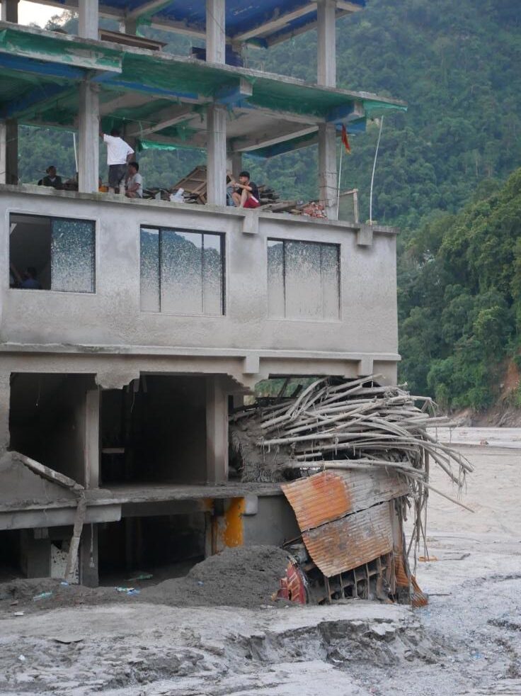
When the day broke, the Teesta was still raging; our collective worst nightmare had come true. The destruction of homes, property, and infrastructure was devastating. Among other victims, twenty-three army personnel who had arrived in Bardang, East Sikkim just the day before were swept away. Only one of the army personnel was found alive several days later.
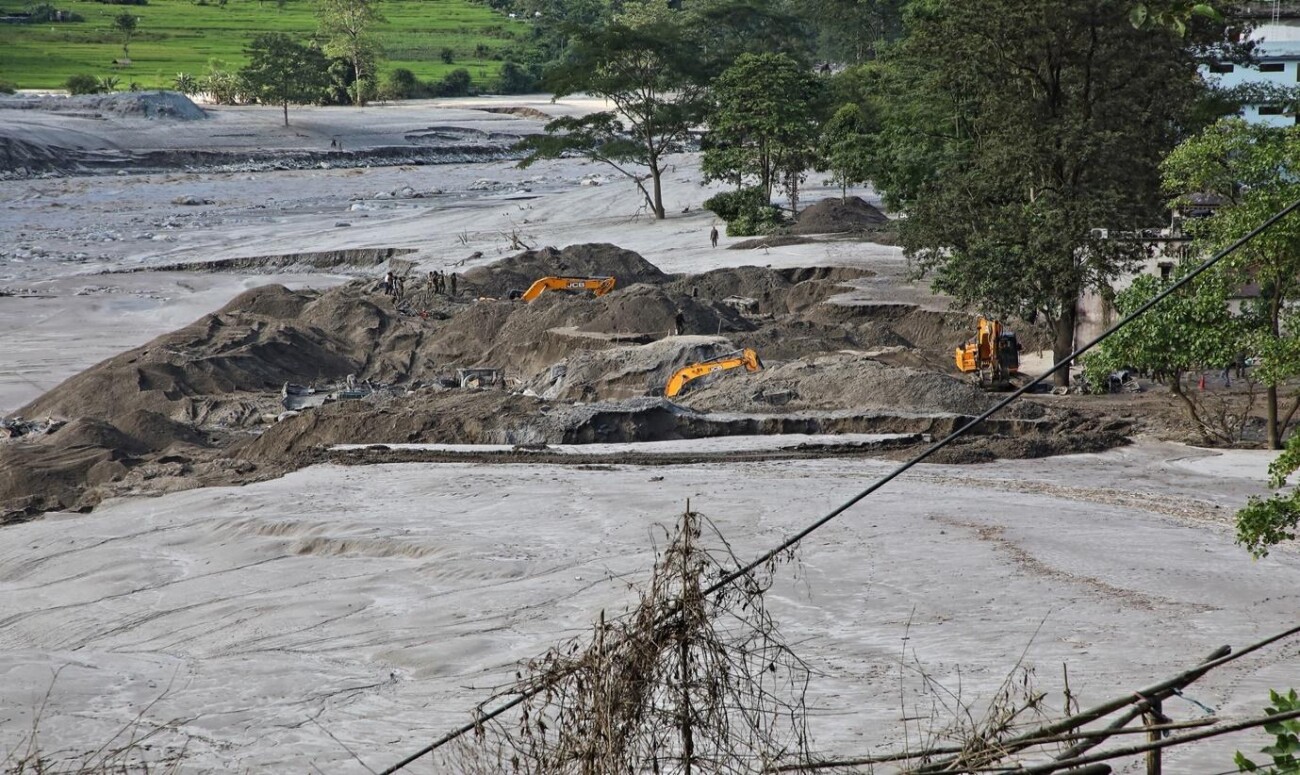
Affected individuals and communities recall harrowing stories of running out of their homes in the darkness and rain, looking for higher ground as the black waters of the Teesta entered homes, swirling around them and engulfing everything in its path.
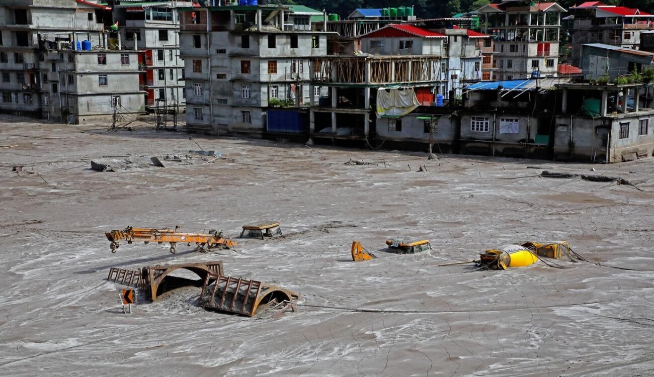
Affected individuals and communities recall harrowing stories of running out of their homes in the darkness and rain, looking for higher ground as the black waters of the Teesta entered homes, swirling around them and engulfing everything in its path. With just minutes to spare, people ran for their lives, with nothing more than the clothes on their backs. The GLOF and the dam burst resulted in the Teesta carrying unimaginable volumes of water at high velocities with tons of debris as tree trunks, boulders, motor vehicles, and infrastructure pieces of collapsed bridges, magnifying the damage and destruction.
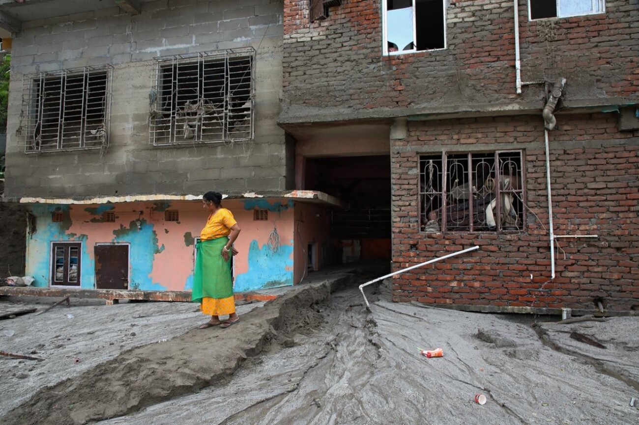
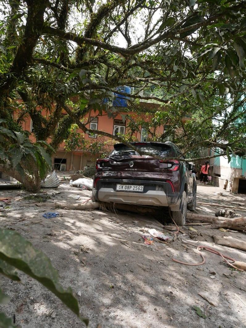
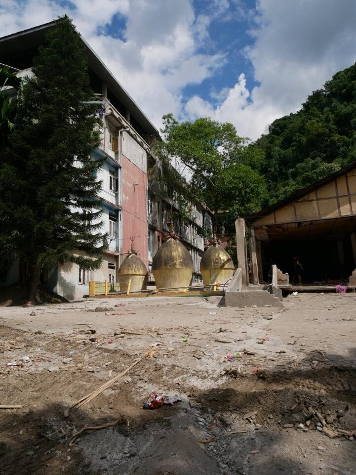
Mud and slush marks on the exterior of the buildings and erosion on the opposite bank bear testament to the Teesta’s water level. A wall of water, almost 15 feet high smashed through everything in its path.
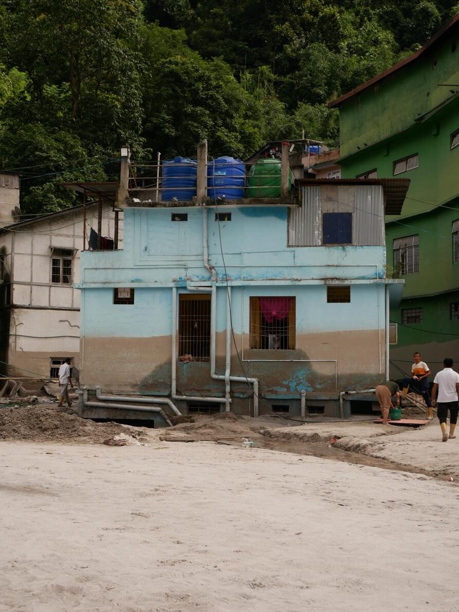
Victims of the flood recalled mistaking the evacuation alarm sounds, for ambulance sirens, while others thought it was just a mock drill. While the early warning system of the GLOF failed and/or did not work, it was the rudimentary alarm system of loud hailers and sirens that worked, alerting people even at 2-3 a.m. in the pouring rain. Most people from the low-lying areas were successfully evacuated in time. However, the death toll might continue to rise as more bodies are unearthed from under 10-15 feet of sand. Himalayan rivers are laden with high quantities of silt. The river washed over dams, homes, villages, army camps, cars burying them and anyone inside them in sand and silt that was several feet high.
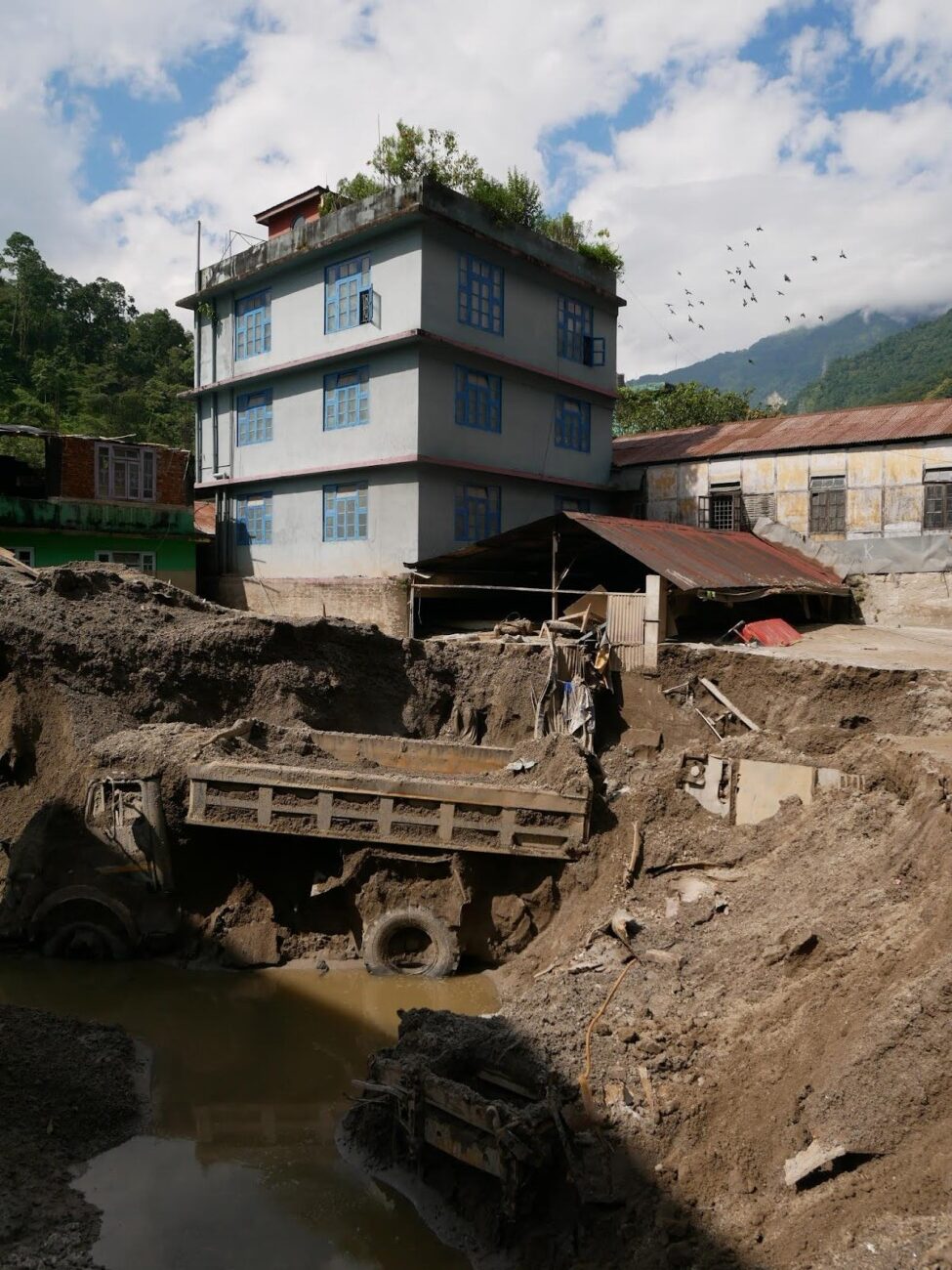
Photo: Mona Chettri
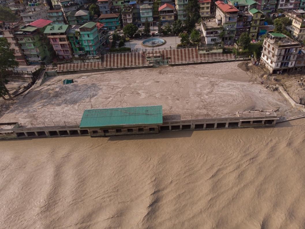
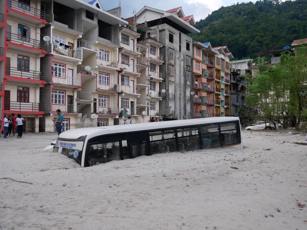
Photo credit: Mona Chettri
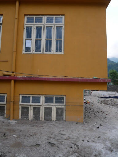
Photo: Mona Chettri
IBM colony of Rangpo town, which was once a thriving market and residential area with over 500 homes, shops, and smaller businesses is now buried under 10-15 feet of sand deposited by the Teesta during its brief but violent visit. Heavy construction material and equipment belonging to DRA construction company lie partly buried at IBM busty. The company contracts had their offices and storage area here, which is now completely buried under the sand. Walking across the vast, flat plain it is hard to imagine that it was once a bustling border town, most of which now lies under the sand.
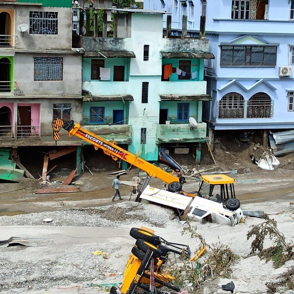
Residents of this complex had a miraculous escape. Having become aware of the floods only after the first floor was engulfed by the waters, about twenty people were compelled to stay on the top floor of the building and wait for 13 hours until personnel of the Sikkim Fire Brigade rescued them. The ground floor and parts of the first floor are still buried in sand.
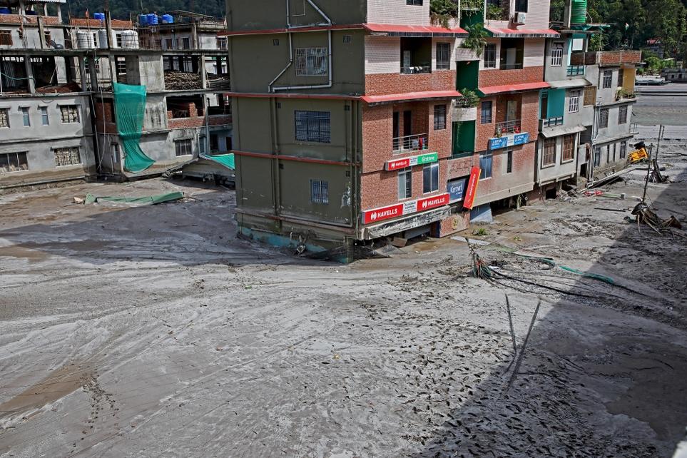
In Teesta Bazaar in West Bengal, the river level had risen to the same height as that of the road. About 45 houses have been lost or damaged, rendering people homeless. Many people have been staying with their friends and relatives.
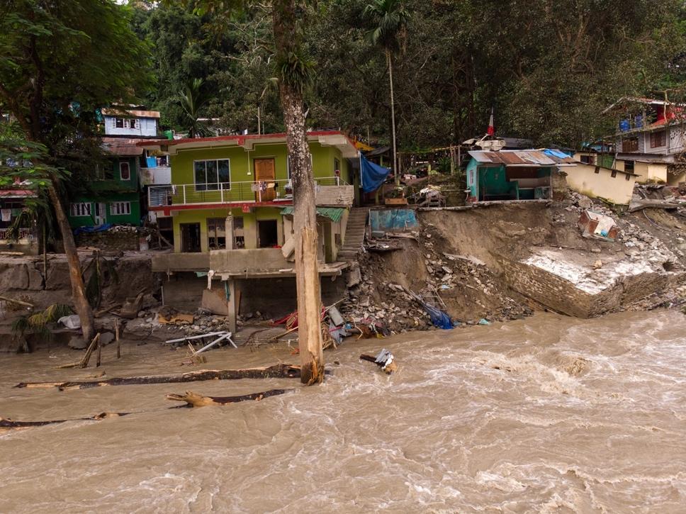
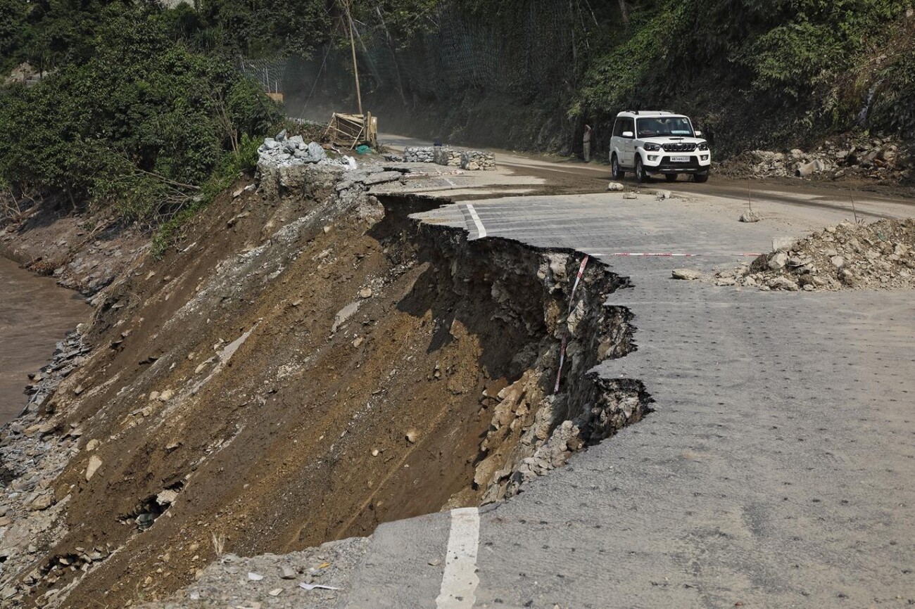
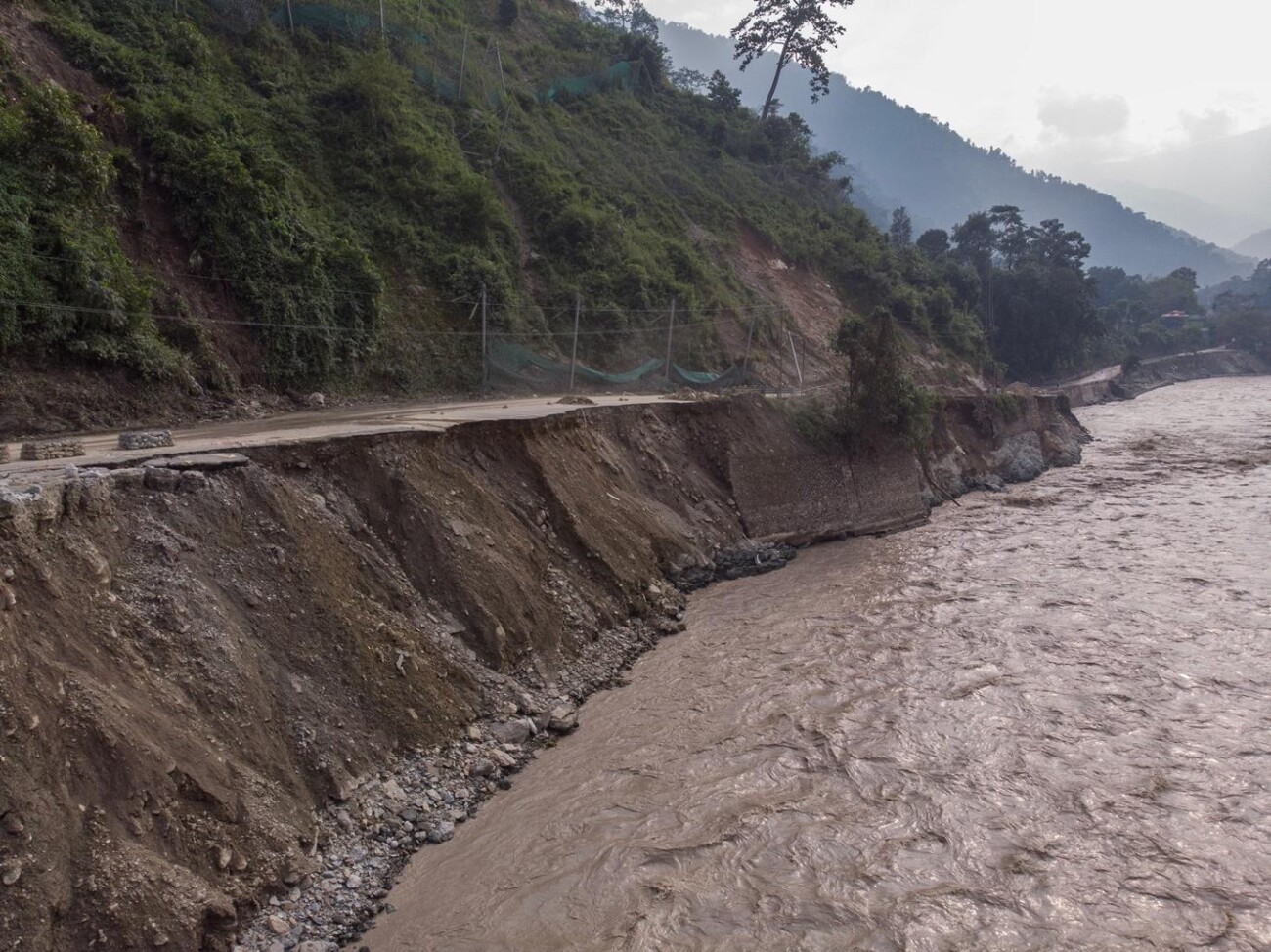
Large sections of National Highway10 were washed away, many of which had already been ravaged by landslides during the monsoon season. This effectively cut Sikkim off from the rest of the country and disconnected different sections of the communities living along the Teesta basin. Anyone wanting to travel to Siliguri had to take a long detour of seven-eight hours through Kalimpong and the Dooars region.
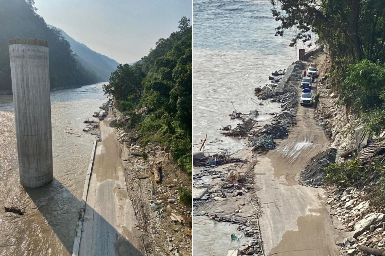
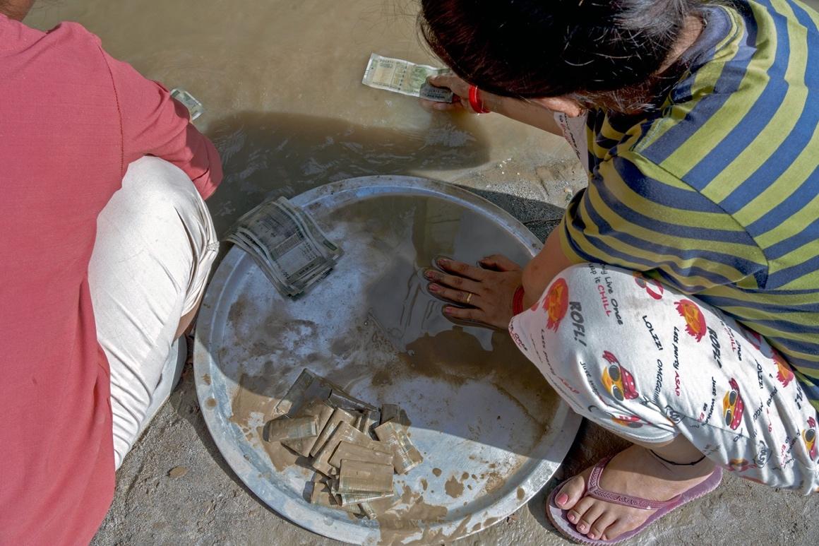
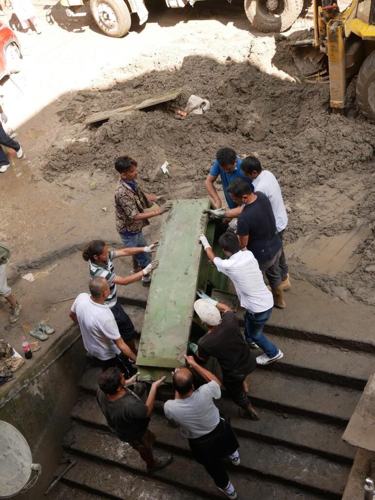
Over the next few days and weeks, people who had walked away from their homes and the flood waters returned to excavate their buried homes and dig out whatever precious or usable items they could find.
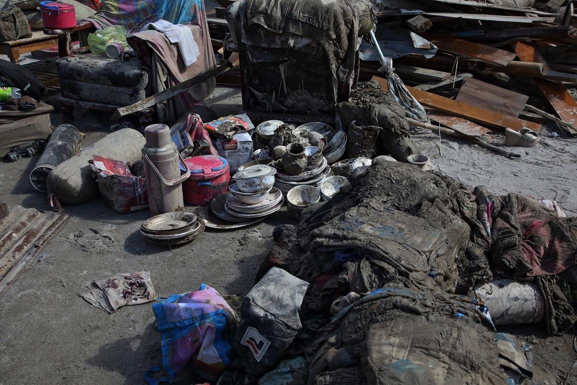
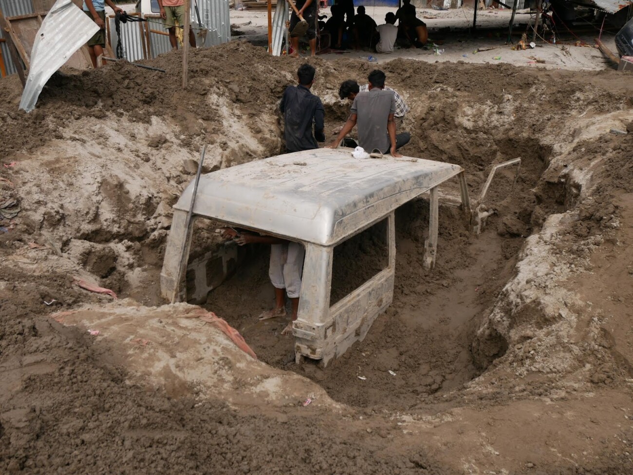

People who had lost everything, especially valuable documents such as ID cards, bank papers, and other important documents were back to forage around in the still slushy, sand and mud for these items.
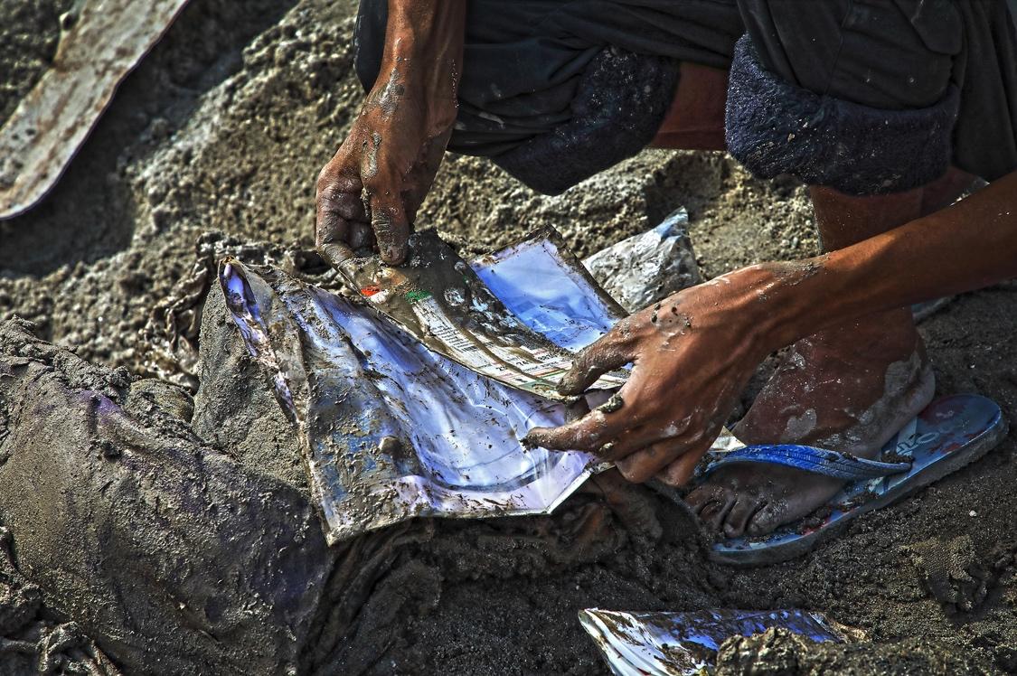
documents, their rehabilitation could be severely hampered/ Photo: Praveen Chettri
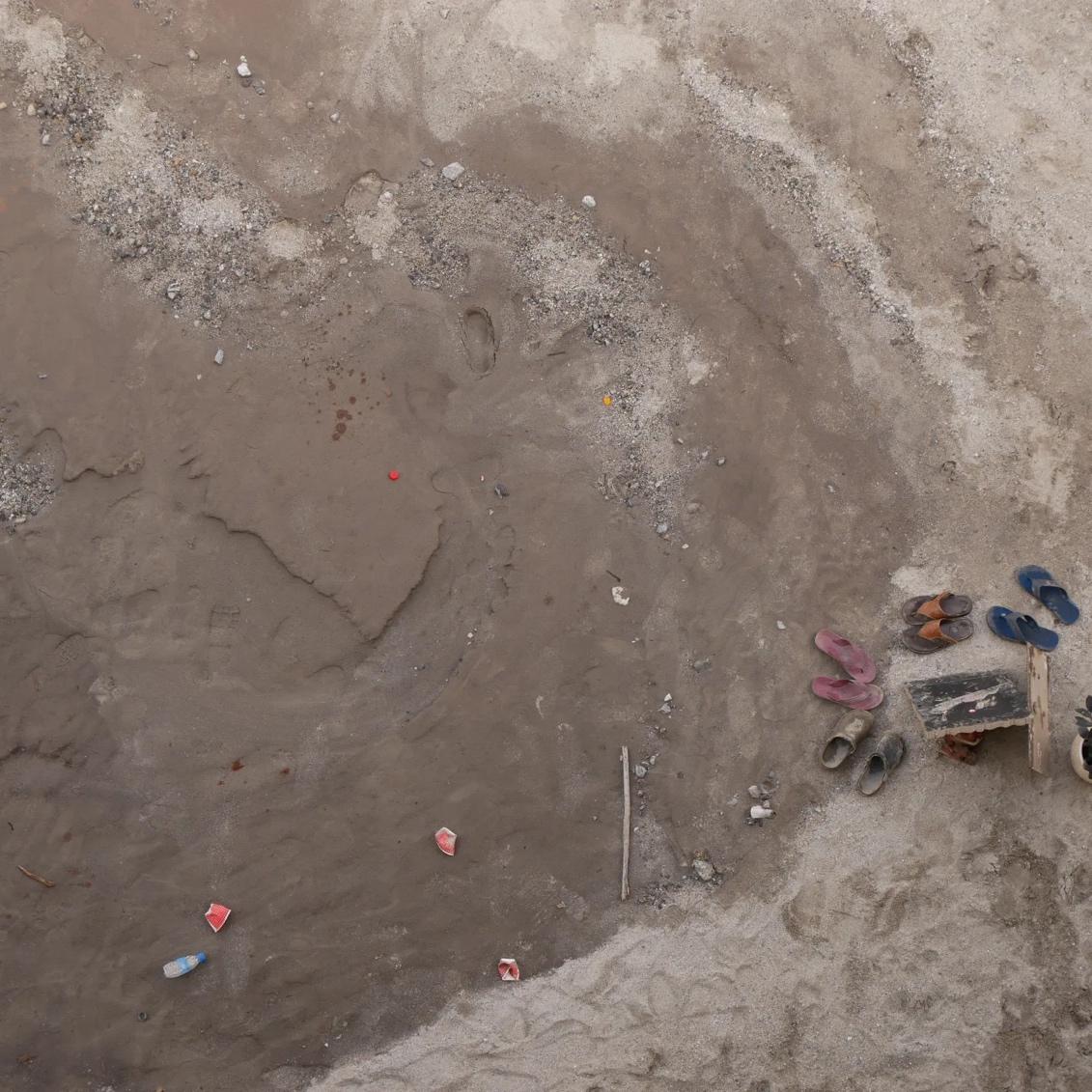
Community support has helped bolster hope and resilience during these dark times. People from across the region and afar have stepped forward to help either through donations and/or manpower required to clear the slush and mud away.
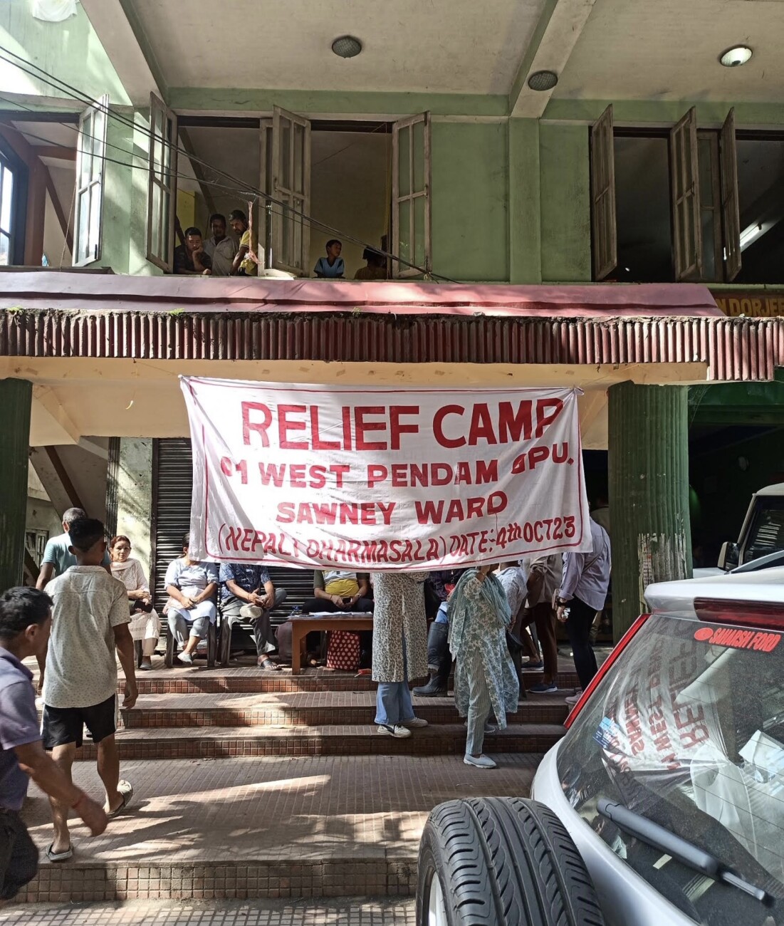
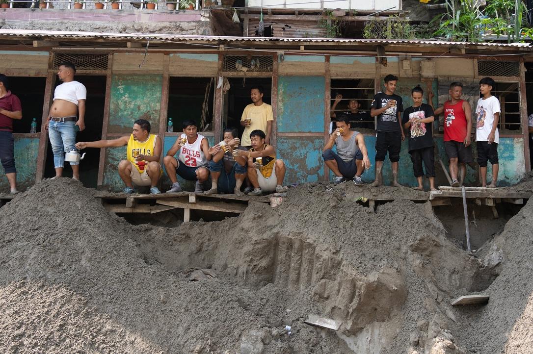
Sikkim/Photo: Mona Chettri
While the October 4 GLOF might have been a natural event, the dam break and the release of water from the dam, compounded the destruction and devastation that ensued. While there have been many questions over dam quality, safety, early warning systems, etc. Perhaps, the question that needs to be asked is about the kind of development that is being pursued in the region. For those who have lost everything to the floods, there is a long road ahead of them in terms of their rehabilitation, as they try and rebuild their lives. And for the rest of us, who have not been directly affected, let us hope this is a wake-up call and will jog our collective consciousness to be alert and active in protecting these hills, valleys, and mountains that we call our home.
References:
Dorjee, Pema Wangchuk, 2015. ‘Sikkim’s Hydel Story’. Summit Times, 04 April, 2018.
ENVIS (Environmental Information System) Hub: Sikkim, ‘Energy’.
https://sikenvis.nic.in/Database/Energy_775.aspx#
Gupta, Moushumi Das, 2023. ‘How an alert ITB jawan on duty 8km away from South Lhonak raised 1 st flood alarm in Sikkim’. The Print, 10 October, 2023.
Sirur, Simrin, 2023. ‘No early warning system and insufficient dam safety turned Sikkim flood deadly.’ Mongabay. October 9, 2023.
Additional references:
Chettri, Mona. 2017. ‘Ethnic Environmentalism in the eastern Himalaya.’ Economic and Political
Weekly. Volume LII, no. 46, pp. 34-40.
Chettri, Mona. 2017. ‘Chungthang: an emerging urban landscape.’ International Institute of Asian
Studies Newsletter, no.77. pp. 36-37.
Dukpa, Rinchu Doma, Deepa Joshi and Rutgerd Boelens. 2019. ‘Contesting hydropower dams in the
eastern Himalaya: the cultural politics of Identity, Territory, and Self-Governance Institutions in
Sikkim, India. Water. Vol. 11, no.3 https://doi.org/10.3390/w11030412
Huber, Amelie. 2019. ‘Hydropower in the Himalayan Hazardscape: Strategic Ignorance and the
Production of Unequal Risk’. Water. Vol.11. no.3. https://doi.org/10.3390/w11030414
Sharma, R.K., Pranay Pradhan, N.P.Sharma and D.G.Shrestha. 2018. ‘Remote sensing and in situ-
based assessment of rapidly growing South Lhonak glacial lake in eastern Himalaya, India.’ Natural
Hazards. Vol. 93, pp. 393-409.
Sherpa, Dawa Yangi. 2022. ‘Environmental Injustice: Hydropower Dams in Sikkim.’ Sikkim Project.
https://www.sikkimproject.org/environmental-injustice-hydropower-dams-in-sikkim-2/
Sphere India. 2023. ‘Preliminary Assessment Report (version III): Flashfloods in Sikkim and north
West Bengal.
Rai, Prava. 2021. 'Making of a Sacred Land and its Guardians.' Sikkim Project https://www.sikkimproject.org/making-of-a-sacred-land-and-its-guardians/
Upadhyay, Himanshu. 2023. ‘How the government covered up the severity of Teesta floods by blaming
them on a ‘cloudburst’. Scroll.in.
https://scroll.in/article/1057436/how-the-government-covered-up-the-severity-of-sikkim-floods-by-blaming-them-on-a-cloudburst
Mona Chettri is a researcher from Gangtok, Sikkim and team member of Reading Himalaya, a research and policy consultancy focussing on the eastern Himalaya. She received her PhD from the School of Oriental and African Studies (SOAS), University of London in 2014. She has worked extensively on urbanisation, ethnicity, environmental politics and development in the eastern Himalayan borderlands of Sikkim, Darjeeling and east Nepal. She is the author of Constructing Democracy: Ethnicity and Democracy in the eastern Himalaya (Amsterdam University Press, 2017) and co-editor of Development Zones in Asian Borderlands (Amsterdam University Press, 2021). She is also the series editor of the Eastern Himalaya Series, an academic publication platform for local research and researchers. Her current research focuses on the intersections between gender, labour, urbanisation and infrastructure in the Sikkim-Darjeeling Himalaya, India and Himalayan immigrant labour in Australia.
Leave a Reply
Latest Posts
Latest Comments
No 'Comments_Widget_Plus_Widget' widget registered in this installation.

